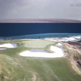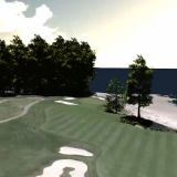

Torrey Pines – #9 – 3D Golf Course
Torrey Pines “South Course” – Hole 9 – Produced with high resolution Photogrammetry and LiDAR terrain modeling. Geospatial data acquired …
Torrey Pines “South Course” – Hole 9 – Produced with high resolution Photogrammetry and LiDAR terrain modeling. Geospatial data acquired …
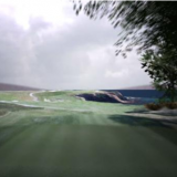
3D Photogrammetry and 3D Point Cloud Modeling Test…
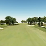
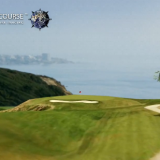
Torrey Pines “South Course” – Hole 18 – Produced with high resolution Photogrammetry and LiDAR terrain modeling. Geospatial data acquired …
Produced with high resolution Photogrammetry and LiDAR terrain modeling. Geospatial data acquired with Microsoft Ultra Cam and Leica HDS LiDAR …
Augmented Reality iPhone Golf Application – High Resolution Photogrammetry, LiDAR and GPS Data.
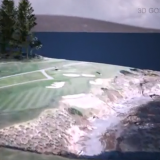
3D Golf Course – Produced with high resolution Photogrammetry and LiDAR terrain modeling. Geospatial data acquired with Microsoft Ultra Cam …
Augmented Reality iPhone Application – High Resolution Photogrammetry, LiDAR and GPS Data.
Augmented Reality iPhone and Android Golf GPS Application. High Resolution Photogrammetry, LiDAR and GPS data.
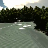
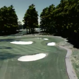
Torrey Pines South Course – Hole 3 – Produced with high resolution Photogrammetry and LiDAR terrain modeling. Geospatial data acquired …