UAV Aerial Cinematography – CNN “Heros Rockclimbing”
Terra Imaging and Compass Data – UAV Aerial Cinematography – "Rock Climbing" from Terra Imaging on Vimeo.
Terra Imaging and Compass Data – UAV Aerial Cinematography – "Rock Climbing" from Terra Imaging on Vimeo.
UAV Drone collected data producing, hyper accurate 3D building models… perfect for 3D gaming, 3D simulation and VFX. Building 1690 …
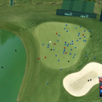
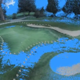
Terra Imaging – Fox Sports – USGA from Terra Imaging on Vimeo.
Terra Imaging – Fox Sports – USGA from Terra Imaging on Vimeo.
June 16th, 2015 – La Jolla, California and Telluride, Colorado – USA Terra Imaging is pleased to announce their FAA …