
Tag: Golf Course GPS

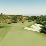
Torrey Pines – 3D Golf Course
Torrey Pines “South Course” – Hole 18 – Produced with high resolution Photogrammetry and LiDAR terrain modeling. Geospatial data acquired …
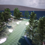
Monterey Peninsula – 3D Photogrammetry and LiDAR
Very exciting, new technologies…