Golf Course GPS
Ballyneal Golf and Hunt Club – Holyoke, CO One Drone Cloud Sketchfab
3D Golf Course ,
Golf Course GPS ,
One Drone Cloud ,
Press ,
UAS - UAV Cinematography ,
UAV ,
UAV Aerial Cinematography ,
UAV Mapping |
3D ,
3D Golf Course ,
ar ,
augmented ,
course ,
drone ,
gis ,
golf ,
GPS ,
mapping ,
maps ,
modeling ,
Photogrammetry ,
reality ,
sim ,
simulator ,
UAS ,
UAV ,
vr
VIDEO
3D Golf Course ,
Golf Course GPS ,
Press ,
UAV Aerial Cinematography ,
UAV Mapping |
3D GIS ,
ar ,
c++ ,
GPS ,
hololens ,
LiDAR ,
mobile ,
open gl ,
Photogrammetry ,
vr
3D Golf Course ,
Golf Course GPS ,
Press ,
UAV Aerial Cinematography ,
UAV Mapping |
3D GIS ,
ar ,
Bing ,
c++ ,
gaming ,
LiDAR ,
opengl ,
Photogrammetry ,
vr
VIDEO
Torrey Pines “South Course” – Hole 9 – Produced with high resolution Photogrammetry and LiDAR terrain modeling. Geospatial data acquired with Microsoft Ultra Cam and Leica HDS LiDAR sensors.
3D Golf Course ,
Apple iPhone - iPad ,
Golf Course GPS ,
Torrey Pines |
Apple ,
Bing ,
Golf Course Mapping ,
LiDAR ,
Microsoft Bing ,
PGA Tour ,
Topography ,
Torrey Pines ,
US Open ,
USGA
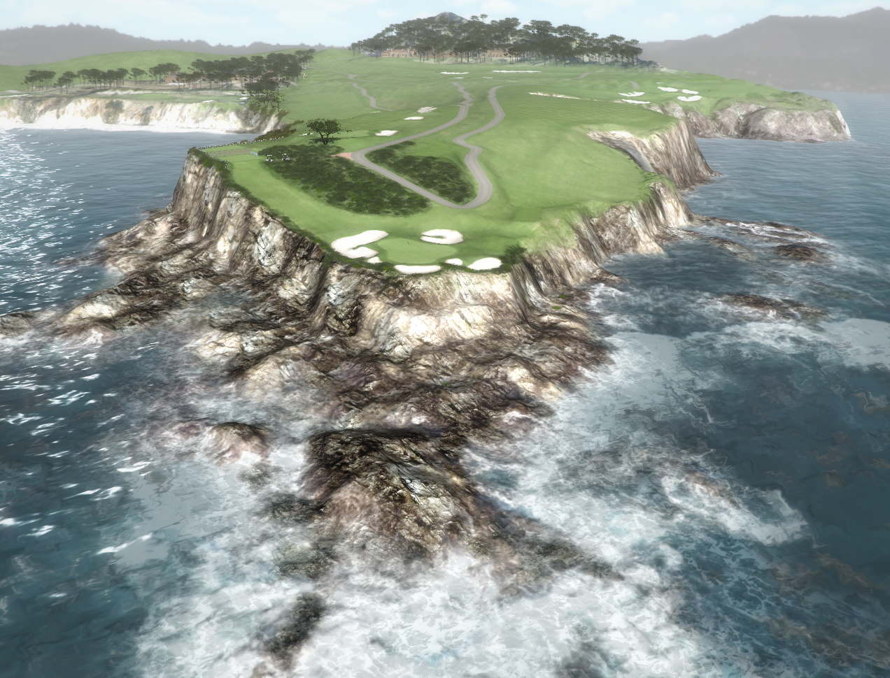
3D Photogrammetry and 3D Point Cloud Modeling Test…
Comments Off on Monterey Peninsula – 3D Golf Course
Torrey Pines “South Course” – Hole 18 – Produced with high resolution Photogrammetry and LiDAR terrain modeling. Geospatial data acquired with Microsoft Ultra Cam and Leica HDS LiDAR sensors…
– 3D Photogrammetry
– 3D Terrestrial LiDAR
3D Golf Course ,
Apple iPhone - iPad ,
Golf Course GPS ,
Torrey Pines ,
UAV Mapping |
Apple ,
Apple iPhone - iPad ,
Bing ,
DEM ,
Drone Mapping ,
Golf Course Mapping ,
LiDAR ,
PGA Tour ,
Torrey Pines ,
UAS Mapping ,
UAV Mapping ,
US Open
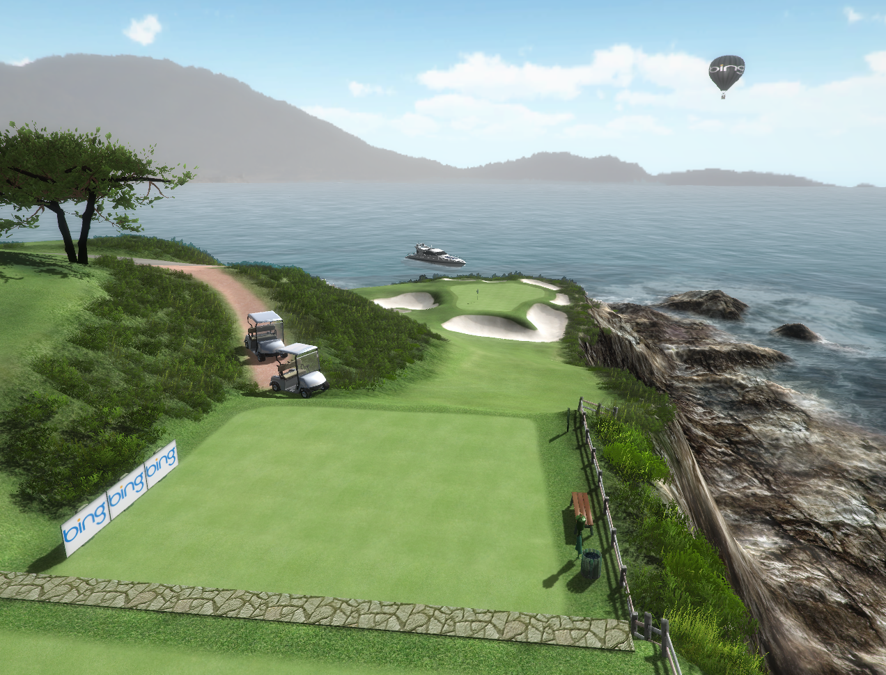
Augmented Reality iPhone Golf Application – High Resolution Photogrammetry, LiDAR and GPS Data.
3D Golf Course ,
Apple iPhone - iPad ,
Golf Course GPS |
Apple iPad ,
Bing ,
DEM ,
Golf Course Mapping ,
Leica ,
LiDAR ,
Microsoft Bing ,
Photogrammetry ,
Terrain ,
US Open ,
USGA Comments Off on 3D Golf Course – Monterey Peninsula
Augmented Reality iPhone and Android Golf GPS Application. High Resolution Photogrammetry, LiDAR and GPS data.
Comments Off on Augmented Reality – Apple iPhone – Golf GPS
Torrey Pines South Course – Hole 3 – Produced with high resolution Photogrammetry and LiDAR terrain modeling. Geospatial data acquired with Microsoft Ultra Cam and Leica HDS LiDAR sensors.
3D Golf Course ,
Apple iPhone - iPad ,
Golf Course GPS ,
Torrey Pines ,
UAV Mapping |
Apple iPad ,
Apple iPhone - iPad ,
Drone Mapping ,
Golf Course Mapping ,
LiDAR ,
PGA Tour ,
Torrey Pines ,
UAS ,
UAV ,
US Open ,
USGA
3D Golf Course ,
Apple iPhone - iPad ,
Golf Course GPS ,
UAV Mapping |
Apple ,
Apple iPad ,
Bing ,
Golf Course Mapping ,
LiDAR ,
Microsoft Bing ,
PGA Tour ,
Photogrammetry ,
Topography ,
Torrey Pines ,
US Open ,
USGA
3D Golf Course ,
Apple iPhone - iPad ,
Golf Course GPS ,
UAV Mapping |
Bing ,
DEM ,
Golf Course GPS ,
Golf GPS ,
Microsoft Bing ,
PGA Tour ,
Photogrammetry ,
US Open ,
USGA Comments Off on Apple iPhone – 3D Augmented Reality
Our friends at Aero Graphics recently acquired a new Optech Orion LiDAR System. Terra Imaging was fortunate enough to begin testing the performance of this new LiDAR system. After the calibration tests were successfully completed, the new airborne laser system was used to collect very high resolution, 3D terrain data over Willow Creek Golf Course in Utah.