Press
The Spirit of Travel by Louis Vuitton – Featuring Emma Stone
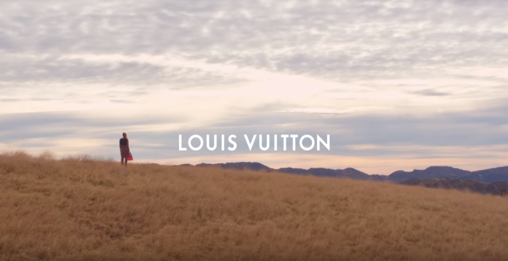
The Spirit of Travel by Louis Vuitton featuring Emma Stone. Aerial Cinematography by Terra Imaging
The Spirit of Travel by Louis Vuitton – Featuring Emma Stone
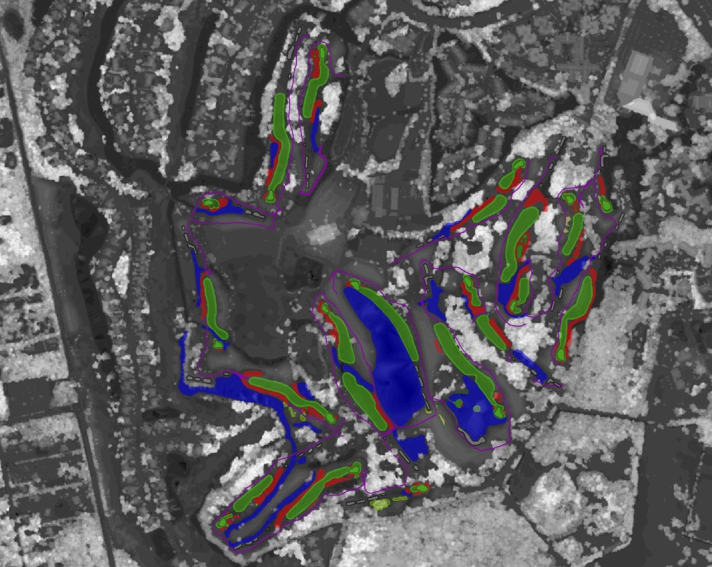
Microsoft Hololens Golf – Hololens Golfcourse Navigation and Visualization
Microsoft Hololens Golf – Hololens Golf Simulation and Hololens Sports Broadcast
Terra Imaging mapping data (airborne stereo photogrammetry) and our 3D Golf Course software running live in Microsoft Hololens.
US Open 2016 – Oakmont Country Club – USGA
Local 600 – International Cinematographers Guild
We are Local 600 and Terra Imaging is proud to be apart of the Local 600. We are honored to be given the opportunity to contribute to this historical Guild. https://www.icg600.com/

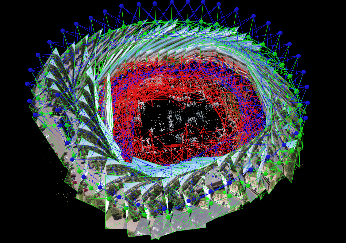
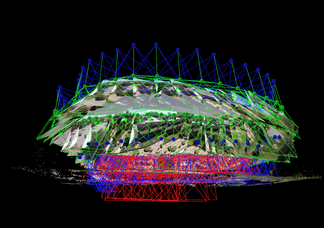
Autonomous Drone Navigation, “SLAM” and Geospatial Data Processing
CES Press Release – San Francisco, CA and Las Vegas, NV – January, 6th 2016
Terra Imaging is pleased to announce an exciting 2016, focusing on their new technology for Autonomous UAS, UAV and Drone Flight Navigation Systems. One Drone Cloud, Terra’s new technology offering, will specifically target the challenges of 3D structural, 3D facilities and 3D object modeling. Ed Gambler, Senior 3D Engineer for Terra Imaging states: “The biggest issue in 3D modeling of physical objects is incomplete Photogrammetry, LiDAR or sensor data captures, resulting in missing data gaps within the final 3D models. These missing data gaps are easily visible as rounded or distorted features such as wavy edges or black holes in overhanging architectural structures. We believe our drone navigation software and “real time”, geospatial processing technologies are now able to recognize and fix the data capture gaps and flight management issues in “real time” during the drone mapping mission.”

Karl Engstrom, CEO of Terra Imaging explains the integration of SLAM (Simultaneous Location and Mapping) methodologies in their flight navigation and geospatial data processing software, “We found out long ago working with Google Earth and Microsoft Virtual Earth that precision flight plans, with precision data captures are some of the paramount variables required to accurately map the world in 3D. Moreover, now with the drone revolution providing low altitude data collection, producing higher resolution datasets , using higher resolution photogrammetry and LiDAR sensors… its a win – win for us, higher resolution, super dense data allows us to produce better geodetic mapping and 3D gaming – entertainment products. Clearly, this revolution is once again becoming a “Big Data” play focusing on autonomous ground and airborne mapping operations.”
Engstrom further comments: “Looking at 2016, Terra Imaging’s focus is on our UAV commercial and cinematography mapping services and our new One Drone Cloud platform. The One Drone Cloud technology team is focused on deploying drone flight navigation software, implementing SLAM methodologies for geospatial data collection, analysis and “real time” 3D structural, 3D environment and 3D object modeling.
We believe the time is right for integrated AI (artificial intelligence) , UAV autonomous navigation and airborne SLAM methodologies to fully empower the drone industry. This technology revolution is taking advantage of fast, drone deployment, fast data collection and fast data processing all collectively producing an extraordinary time to be in the airborne mapping and cinematography industry.
In summary, it’s an exciting time for the geospatial industry, especially for the insiders who have seen this before with fixed wing planes, helicopters and million dollar mapping cameras and LiDAR sensors… Our industry, friends and colleagues have come a long way in the last 16 years.”
For more information please visit:
Terra Imaging – http://www.terraimaging.com
One Drone Cloud – http://www.onedronecloud.com
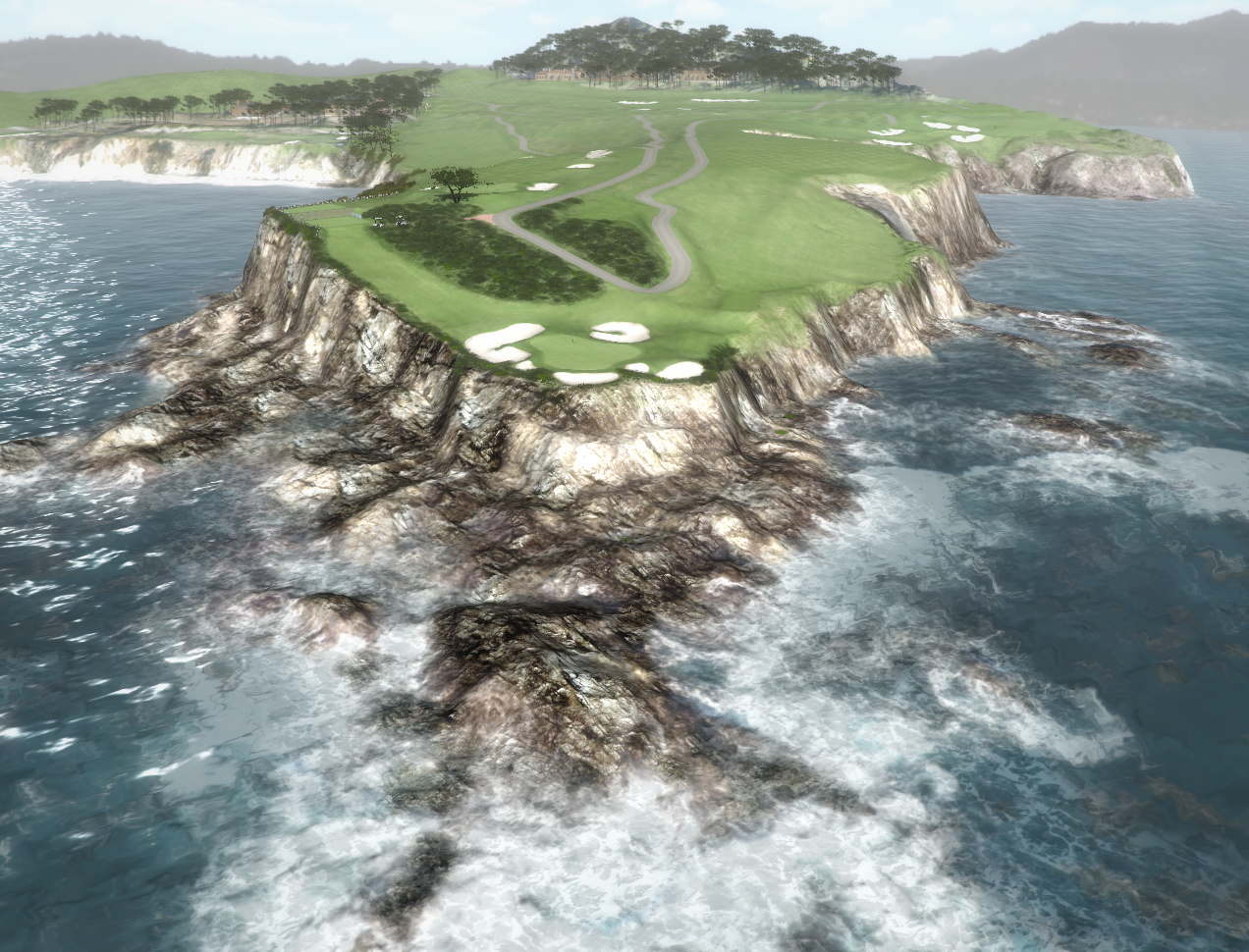
Ballyneal Golf and Hunt Club – Holyoke, CO – UAV Photogrammetry and 3D Modeling
Ballyneal Golf and Hunt Club – Holyoke, CO
by One Drone Cloud
on Sketchfab
FAA Approval: Commercial UAV Operations – UAV Aerial Mapping and UAV Aerial Cinematography

June 16th, 2015 – La Jolla, California and Telluride, Colorado – USA
Terra Imaging is pleased to announce their FAA approval for commercial UAS, UAV and Drone operations in the United States. Karl Engstrom, CEO of Terra Imaging explains, “This is a pretty big announcement for us, we are very pleased. We’ve been in the airborne mapping industry for several decades, now with the recent FAA legislation this year allowing for commercial UAV operations in the US, we couldn’t be more pleased with our approval for both categories of UAV operations: “Precision Aerial Surveys” and “Closed Set Cinematography”… it’s a first for us and the geospatial industry.”
Lawrence Lim, Director of Photography and Cinematographer for Terra Imaging states: “We are going to continue to work with our existing airborne mapping clients for golf course, real estate, civil engineering and agriculture mapping, however, we are going to continue to focus on UAV technology for the motion picture and commercial television industry as well. Focusing on the Motion Picture and Television industry is going to be an exciting next step in our evolution of airborne data collection, we are very excited about this emerging industry of high resolution, low altitude data collection.”
Engstrom summarizes, “We are just at the start, at the forefront of this new emerging technology sector, UAV operations will forever change the traditional industries of motion picture, sports broadcast, airborne photogrammetry, civil engineering and GIS… the list goes on, its just the beginning, we are very excited and optimistic about the future.”


The Geospatial Revolution Project
From our friends and alumni at Penn State, ESRI, GeoEye and ASPRS…